Search results
(1 - 20 of 31)
- Title
- Le pays des Hottentots aux environs du Cap de Bonne Esperance
- Subject
- Cape of Good Hope (South Africa) -- Maps -- Early works to 1800.
- Description
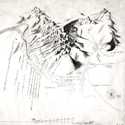
- Map depicts the coast from St Helena Bay to Mossel Bay and the corresponding area inland., Relief shown pictorially., Text is in French and Dutch., "J. v. Schley direx.", "Lieues Marines de France et d'Angleterre de 20 au Degré." "Lieues d'Allemagne de 15 au Degré.", UCT Libraries hold 2 copies. One copy (566a) is hand coloured; one copy (566b) is uncoloured.
- Identifier
- islandora:19708
- Title
- Karte vom Süd-Ende Afrika's und dem Cap-Colonie-Lande
- Subject
- Cape of Good Hope (South Africa)--Maps., South Africa--Maps, , ,
- Description
- Map of South Africa and the Cape Colony. The map shows districts, towns, villages, roads, rivers and mountains. The map also indicates the routes taken by Henry Lichtenstein and John Campbell. An inset map depicts the cape peninsula and False Bay. Scale not given.
- Identifier
- islandora:30097
- Title
- Graham's Town and the outposts with their bearings and distances
- Subject
- Cape of Good Hope (South Africa) -- Maps., Eastern Cape (South Africa) -- Maps.
- Description
- South Eastern Cape districts showing Somerset [East], Uitenhage, Albany (Grahamstown, Salem, Bathurst, Post Retief), Victoria (Fort Beaufort, Fort Peddie), King William's Town, and the Great Fish River. Wyld's map features towns, forts and posts with distances between them as well as rivers and mountains.
- Identifier
- islandora:19526
- Title
- Übersicht der Trigonometrischen & Nautischen aufnehmen in Kaplande bis 1867--[cartographic material]
- Subject
- Cape of Good Hope (South Africa)--Maps., Nautical charts--South Africa--Cape of Good Hope.
- Description
- Trigonometrical and navigational map of the southern portion of the Cape of Good Hope showing the southern African coast from St Helena Bay, Saldanha Bay and False Bay in the south and west to Cape Morgan in the east and the Compassberg in the north., Relief shown by spot heights. Depths shown by contours and soundings., Projection not given. Bar scale in German miles., Inset: Südliches Ende der Agulhas Bank [the southern end of the Agulhas Bank]., Appears in Mittheilungen aus Justus Perthes' geographischer Anstalt über wichtige neue Erforschungen auf dem Gesammtgebiete der Geographie / von A. Petermann. Gotha : Justus Perthes, 1868.
- Identifier
- islandora:19590
- Title
- Map to accompany report on authorized extension of railway system
- Subject
- Railroads--South Africa--Cape of Good Hope--Maps, ,
- Description
- A map of northern and eastern parts of the Cape Colony showing an authorised and alternative railway extension from Cradock to Colesberg, joining the authorised and alternative extension from Beaufort West to Hope Town, with towns and other place names, district boundaries, mountains and rivers. Relief shown by hachures. Some colour. No scale given.
- Identifier
- islandora:25116
- Title
- Carpobrotus acinaciformis (L.) L.Bolus
- Subject
- South Africa--Cape of Good Hope, Aizoaceae--South Africa--Western Cape--Pictorial works, Botany--South Africa--Western Cape--Pictorial works, Vygie
- Description
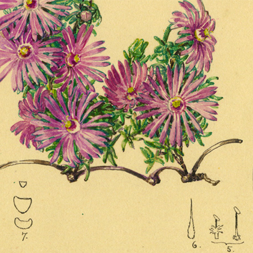
- Botanical illustration - coloured - Carpobrotus acinaciformis. Dissected drawing of flower included. Drawn from a collection made at Cape Point [Kaappunt, Cape District] by R.H. Compton, 13 September 1926. Flowers in September. Fruit drawn on the 29 November 1926.
- Identifier
- islandora:22953
- Title
- Union of South Africa, south western sheet
- Subject
- South Africa--Description and travel--Maps, Cape of Good Hope (South Africa)--Description and travel--Maps, ,
- Description
- Map showing the south western part of South Africa, with Cape of Good Hope, districts, towns and villages, names of places, provincial boundaries, railways, roads, and rivers. Scale: 15.77 miles = 1 inch. No projection given.
- Identifier
- islandora:29930
- Title
- Sketch of the Territories on the Vaal River to accompany the Award of His Excellency R.W. Keate Esqre Lieut. Governor of Natal in the arbitration between the S.A. Republic & the Batlapin Baralong & Bangoakelze Native tribes and Nicholas Waterboer, paramount Chief of Griqualand West. Appendix map III
- Subject
- Africans--South Africa--Cape of Good Hope--Administration--Maps, Africans--South Africa--Transvaal--Administration--Maps, Griqualand West (South Africa)--Maps, , ,
- Description
- Map showing boundaries of territories of the Griqua, the Barolong, Bangoaletze and Batlapin tribes, with rivers and some relief shown by hachures. Some colour. Scale 1/8 inch to 10 miles.
- Identifier
- islandora:25143
- Title
- Carta geografica del Capo di Buona Speranza
- Subject
- Cape of Good Hope (South Africa) -- Maps -- Early works to 1800.
- Description
- The map spans the area from Saldanha Bay to False Bay and shows land cultivated by the Dutch East India Company (with Italian versions of the names of many of the early farmers), sweet water wells, salt pans, woods, rivers and sailing ships off the West Coast. The map indicates "Isola di Robbi" (Robben Island) and "Isola de Daini" (Dassen Island), routes to the homesteads of indigenous peoples and the real or imagined location of "Elefanti", "Tigri" and "Rinoceri". Included is a detailed, ornamental, coloured cartouche depicting an elephant, a rhinoceros, people building a hut with wood and grass, trees, ships at anchor and mountains across the bay., Relief shown pictorially., Appears in: Atlante novissimo che contiene tutti le parti del mondo / Guillaume de l'Isle. Venice : Presso Giambatista Albrizzi, 1740-1750., "Scala di Miglia 15 Italiane 60 in un grado"., Restored and hinged between acid-free boards.
- Identifier
- islandora:19706
- Title
- Le Pays des Hottentots aux environs du Cap de Bonne Espérance
- Subject
- South Africa -- Maps -- Early works to 1800., Cape of Good Hope (South Africa) -- Maps -- Early works to 1800.
- Description
- Shows coast from St Helena Bay to Mossel Bay and corresponding area inland., Relief shown pictorially., Text in French., Bottom left of map: "Tome V. in 4o. No. 5"; bottom right of map: "Tome 3. in 8o Page 391"., Scale in English, French and German leagues., UCT Libraries hold 3 copies of this map. One copy (425a) is hand coloured. One copy (425c) does not have the statement "Tome V. in 4o. No. 5" at bottom left of map.
- Identifier
- islandora:19703
- Title
- Le Pays des Hottentots aux environs du Cap de Bonne Espérance
- Subject
- South Africa -- Maps -- Early works to 1800., Cape of Good Hope (South Africa) -- Maps -- Early works to 1800.
- Description
- Shows coast from St Helena Bay to Mossel Bay and corresponding area inland., Relief shown pictorially., Text in French., Bottom left of map: "Tome V. in 4o. No. 5"; bottom right of map: "Tome 3. in 8o Page 391"., Scale in English, French and German leagues., UCT Libraries hold 3 copies of this map. One copy (425a) is hand coloured. One copy (425c) does not have the statement "Tome V. in 4o. No. 5" at bottom left of map.
- Identifier
- islandora:19704
- Title
- Parliamentary Precinct
- Subject
- South Africa ; Western Cape, Province of the ; Cape Town, Gardens (open spaces), Good Hope Theatre (Cape Town, South Africa), Landscape architecture--South Africa--Cape Town, Public buildings--South Africa--Cape Town--Landscape architecture, Tuynhuys (Cape Town, South Africa)
- Description
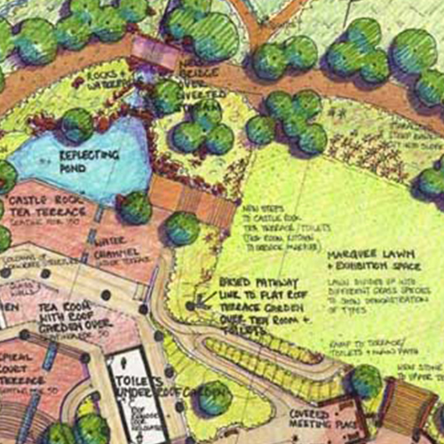
- Good Hope Theatre and part of Tuynhuys, Cape Town, Western Cape. Parliamentary accommodation. Landscape sketch proposals: South Garden to the Good Hope Theatre, within the Parliamentary Precinct, Cape Town. This hand-drawn landscape plan is rendered with Pantone colour application, and indicates, with annotations, proposed planters, pathways and terraces., Scale 1:100
- Identifier
- islandora:22392
- Title
- Le Pays des Hottentots aux environs du Cap de Bonne Espérance
- Subject
- South Africa -- Maps -- Early works to 1800., Cape of Good Hope (South Africa) -- Maps -- Early works to 1800.
- Description
- Shows coast from St Helena Bay to Mossel Bay and corresponding area inland., Relief shown pictorially., Text in French., Bottom left of map: "Tome V. in 4o. No. 5"; bottom right of map: "Tome 3. in 8o Page 391"., Scale in English, French and German leagues., UCT Libraries hold 3 copies of this map. One copy (425a) is hand coloured. One copy (425c) does not have the statement "Tome V. in 4o. No. 5" at bottom left of map.
- Identifier
- islandora:19705
- Title
- Plan of that portion of the demarcated Zitzikamma forests situated between the Storms River and Blaauw Kranz River in the Division of Humansdorp
- Subject
- Tsitsikamma (South Africa) -- Maps., Cape of Good Hope (South Africa) -- Maps.
- Description
- Plan of the Tsitsikamma Forest showing different forest areas. The plan also gives cadastral details with farm lot numbers, a table of co-ordinates, a table of connections and areas of forests. Included on the table of co-ordinates is a list of areas of farm lots which have to be deducted from the demarcated figure. A note on the plan indicates the portions of forest which have been opened for felling., Lithographed in the Surveyor General's Office., The map has been badly torn and damaged. Some text is missing and there are substantial tears along the folds.
- Identifier
- islandora:19602
- Title
- Sketch of the Territories on the Vaal River to accompany the Award of His Excellency R.W. Keate Esqre Lieut. Governor of Natal in the arbitration between the S.A. Republic & the Batlapin Baralong & Bangoakelze Native tribes and Nicholas Waterboer, paramount Chief of Griqualand West. Appendix map III
- Subject
- Africans--South Africa--Cape of Good Hope--Administration--Maps, Africans--South Africa--Transvaal--Administration--Maps, Griqualand West (South Africa)--Maps, , ,
- Description
- Map showing boundaries of territories of the Griqua, the Barolong, Bangoaletze and Batlapin tribes, with rivers and some relief shown by hachures. Some colour. Scale 1/8 inch to 10 miles.
- Identifier
- islandora:29804
- Title
- Le pays des Hottentots aux environs du Cap de Bonne Esperance
- Subject
- Cape of Good Hope (South Africa) -- Maps -- Early works to 1800.
- Description
- Map depicts the coast from St Helena Bay to Mossel Bay and the corresponding area inland., Relief shown pictorially., Text is in French and Dutch., "J. v. Schley direx.", "Lieues Marines de France et d'Angleterre de 20 au Degré." "Lieues d'Allemagne de 15 au Degré.", UCT Libraries hold 2 copies. One copy (566a) is hand coloured; one copy (566b) is uncoloured.
- Identifier
- islandora:19709
- Title
- Sketch of British Kaffraria
- Subject
- Kaffraria-- History--Maps, Xhosa (African people)--Colonisation--South Africa --Cape of Good Hope, Great Britain--Colonies--Administration--History--19th Century,
- Description
- Map showing British Kaffraria, with royal reserve, rivers, and names of places. Coloured. Scale 25 Miles to 3 Inches.
- Identifier
- islandora:30033
- Title
- Braunsia apiculata (Kensit) L.Bolus
- Subject
- South Africa--Cape of Good Hope, Aizoaceae--South Africa--Western Cape--Pictorial works, Botany--South Africa--Western Cape--Pictorial works, Vygie
- Description
- Botanical illustration - coloured - Braunsia apiculata. Dissected drawing of flower included plus dissected flower in attached capsule. Drawn from a collection made by Frith (sub-National Botanical Garden 1378/19), Cape Province.
- Identifier
- islandora:22916
- Title
- Wreck of Windsor Castle
- Subject
- Shipwrecks -- South Africa -- Cape Town., Nautical charts -- South Africa -- Cape of Good Hope., Cape of Good Hope (South Africa) -- Maps.
- Description
- Marine chart showing where the Windsor Castle, a 2,672 ton steamer, was wrecked off Dassen Island on 19 October 1876. This chart was specially prepared for the Standard and Mail newspaper. In addition to the site of the wreck, the map shows Camps Bay, Green Point, Mouille Point, the Cape Town docks, Observatory, the Salt River and Riet Vlei, Whale Rock, Robben Island, Blaauwberg and Blaauwberg River, Melkbosch Point, Seal Cove, Matroos Bay and Point, Buffels River, Bok River, Bok Point, Jacob's Cove, Gans Kraal Farm, Black Rock, Moeder River, Darling, Rondeberg, Ijzer Fontein Point, Rondeberg Breaker, and Dassen Island with Roaring Sister, South Rock, South West Breakers, West Ledge, The Triangles, Boom Point and Waterloo Bay., Depths shown by soundings., Projection not given. Map shows a variation of 29°50' between magnetic north and true north., Saul Solomon & Co.
- Identifier
- islandora:19685
- Title
- Parliamentary Precinct
- Subject
- South Africa ; Western Cape, Province of the ; Cape Town, Gardens (open spaces), Good Hope Theatre (Cape Town, South Africa), Landscape architecture--South Africa--Cape Town, Public buildings--South Africa--Cape Town--Landscape architecture, Tuynhuys (Cape Town, South Africa)
- Description
- Good Hope Theatre and part of Tuynhuys, Cape Town, Western Cape. Parliamentary accommodation. Landscape sketch proposals: South Garden to the Good Hope Theatre, within the Parliamentary Precinct, Cape Town. This hand-drawn landscape plan and elevation is rendered with Pantone colour application and shadow projection, and indicates, with annotations, proposed planters, pathways and terraces., Scale 1:100
- Identifier
- islandora:22391
Share