Search results
(1 - 20 of 323)
- Title
- Transkei
- Subject
- South African War, 1899-1902 -- Maps., Transkei (South Africa) -- Maps., Eastern Cape (South Africa) -- Maps.
- Description
- 1st ed., This map forms part of the Imperial map of the Cape Colony., The map shows main roads, branch roads, farm roads, rivers, hills, pans, railways, telegraph lines, farm names, farm boundaries, divisional boundaries, outspans and homesteads in the Transkei region., Relief shown by hachures., "South Africa having never been properly surveyed, this map must necessarily contain many inaccuracies.", Projection not given., Printed in black, red, brown and blue., The maps are printed on linen.
- Identifier
- islandora:24861
- Title
- Map of Cape Town central and neighbouring suburbs
- Subject
- Cape Town (South Africa) -- Maps.
- Description
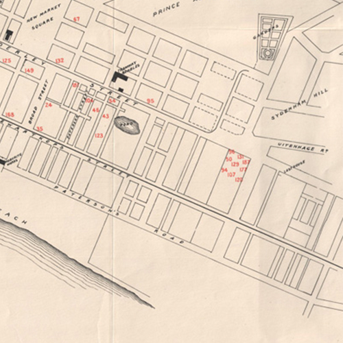
- Map shows tramways, railways, principal buildings, bathing places (including the "New Swimming Baths" at Woodstock), the foreshore area and harbour area, marking Victoria Dock, Alfred Dock and the position of the New Basin. Map gives the distances from Adderley Street to various suburbs and other centres as well as available means of transport. There is additional tourist information on the verso of the map., South African Railways and Harbours.
- Identifier
- islandora:19894
- Title
- C.G.R. flying survey : Graaff Reinet Middelburg Road, 1896
- Subject
- Railroads--South Africa--Graaff-Reinet--Maps, Railroads--South Africa--Middelburg (Eastern Cape)--Maps, ,
- Description
- Map showing proposed railway line from Graaff Reinet, past Middelburg, to meet with the existing railway at Middelburg Road station, with farms, roads and rivers. Some colour. Scale about 3/8 inch to 1 mile.
- Identifier
- islandora:25134
- Title
- Kalk Bay
- Subject
- Kalk Bay (South Africa) -- Maps., Cape Peninsula (South Africa) -- Maps.
- Description
- Maps of the Kalk Bay area with sheets for Clovelly, Kalk Bay itself and St James. The maps show streets, roads, the railway line, railway stations, buildings (domestic and business), churches, schools, playing fields, the wash house, rivers, the shore line, Woolley's Pool, Kalk Bay harbour, Dalebrook Pool, Danger Beach, Aquarium Gully and the Kalk Bay pavilion, bathing pool and swimming pool., Relief shown pictorially., The maps are stapled together between 2 covers., 01. Clovelly, EC 95 / surveyed by E. Cuthbert, May 1951 ; drawn by K. Powell, Aug. 1952 -- 02. Clovelly, ED 95 / surveyed by E. Cuthbert, May 1951 ; drawn by M. Ebdon, Aug. 1952 -- 03. Kalk Bay, ED 94 / surveyed by R. Taylor, Dec. 1950 ; drawn by J. Pelczyński, July, 1952 -- 04. Kalk Bay, ED 93 / surveyed by E. Cuthbert, Nov. 1950 ; drawn by K. Powell, March 1952 -- 05. Kalk Bay, EE 95 / surveyed by W. Black, Jan. 1951 ; drawn by A. Spencer-Hicken, July, 1952 -- 06. Kalk Bay, EE 94 / surveyed by R. Taylor, Nov. 1950 ; drawn by A. Spencer-Hicken, June, 1952 -- 07. Kalk Bay, EE 93 / surveyed by E. Cuthbert, Feb. 1951 ; drawn by E. Wagstaffe, J. Pelczyński, Sept. 1952 -- 08. Kalk Bay, EE92 / surveyed by G. Hodgson, Nov. 1950 ; drawn by E. Wagstaffe, July 1952 -- 09. St James, EF 90 / surveyed by F. Bayley, Jan. 1951 ; drawn by A. Spencer-Hicken, Nov., 1951 -- 10. Kalk Bay, EF 92 / surveyed by G. Hodgson, Oct. 1950 ; drawn by K. Powell, June 1952 -- 11. St James, EF 91 / surveyed by E. Hansen, Sept. 1950 ; drawn by M. Ebdon, July 1952 -- 12. St James, EG 91 / surveyed by E. Hansen, P. Wood-Pottle ; drawn by M. Ebdon, Feb. 1951.
- Identifier
- islandora:19843
- Title
- Map of central Cape Town
- Subject
- Cape Town (South Africa) -- Maps.
- Description
- Map shows names of principal streets, the railway system, Table Bay, foreshore development, and an index to main buildings and places of interest., The map is torn and poorly mended.
- Identifier
- islandora:19922
- Title
- C.G.R. Port Elizabeth-Avontuur to accompany Mr. Tippett's report dated May 31st 1898
- Subject
- Railroads--South Africa--Eastern Cape--Maps,
- Description
- Map showing railway line from Avontuur to Port Elizabeth, with rivers, roads and small place names. Some colour. Scale 1 cm to 10 miles
- Identifier
- islandora:25079
- Title
- Sketch map of the country between the Kowie and the Chalumna Rivers showing the Fingo and Kafir locations, general lay of the country &c, &c
- Subject
- Geology -- South Africa -- Eastern Cape., Eastern Cape (South Africa) -- Maps.
- Description
- Map gives cadastral details including field-cornetcy boundaries and numbers, farm boundaries, farm names and the territories of leaders including Jokweni, Matomela, Kama, Kaulela, Toise, Siwani and Jali. Map also shows towns and villages including Bathurst, Clumber, Peddie and Hamburg., Projection not given. Coordinates not given., Annotated in blue pencil: "Recd from Mr. Henkel 9/1/77 H.E. Richard Bright."
- Identifier
- islandora:19617
- Title
- General plan of the diamond fields, to illustrate the Report of the Surveyor of Mines dated Feby. 28th 1883
- Subject
- Diamond mines and mining--South Africa--Northern Cape--Maps,
- Description
- Map showing the diamond mines around Kimberley and Beaconsfield, namely, Kimberley Mine, Old de Beer's Mine, Bultfontein Mine and Du Toit's Pan Mine, within the divisions of Alexanderfontein, Bultfontein, Vooruitzigt, Dorstfontein and Benauwheidfontein, with roads. Scale 1 inch to 20 chains.
- Identifier
- islandora:25122
- Title
- Divisional map of Wodehouse. Shewing its educational conditons and requirements
- Subject
- Schools--South Africa--Wodehouse--Maps, Schools--South Africa--Eastern Cape--Maps,
- Description
- A map showing existing schools and possible centres for schools, with divisional boundaries, main divisional and branch roads, commonages, towns and villages and ordinary roads. Some colour. Scale 1 English inch to 800 Cape roods
- Identifier
- islandora:25108
- Title
- Douglas irrigation
- Subject
- Irrigation--South Africa--Douglas (Northern Cape)--Maps, Land use--South Africa--Douglas (Northern Cape)--Maps,
- Description
- A map of the agricultural and town land lots surveyed in the village of Douglas. The map shows the lots sold or unsold, agricultural lots reserved, land under irrigation, main furrows, distribution channels and flumes, with the Vall Riverand roads. The map is on a third of the sheet, the rest of the sheet is taken up by tables of agricultural lots and town lots sold. Some colour. Scale 1 inch to 8 chains.
- Identifier
- islandora:25197
- Title
- Cape Colony. Kenhardt
- Subject
- Kenhardt Region (South Africa) -- Maps., Northern Cape (South Africa) -- Maps., Cape of Good Hope (South Africa) -- Maps.
- Description
- Topographical map indicating Kenhardt and other towns and villages, roads, rivers, mountains and other features in the area surrounding Kenhardt., Relief shown by contours, form lines and spot heights., Projection not given., Map folds into an outer cover., Includes index to adjoining sheets., Includes a table listing halting places., Includes a general note commenting on: nature of country, roads, transport, water, fuel, grazing, supplies and Kenhardt., Includes ancillary map: Kenhardt (scale 1 in. to 1 mile)., Sheet South H-34/J., Mounted on cloth.
- Identifier
- islandora:24930
- Title
- Cape of Good Hope
- Subject
- South Africa--Cape of Good Hope--Maps, Cape of Good Hope (South Africa)--History--Maps, ,
- Description
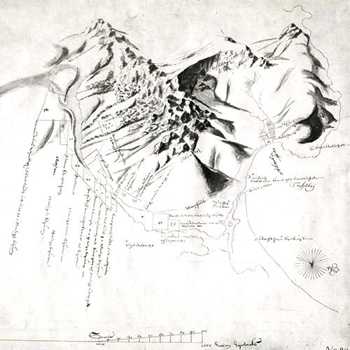
- Map of Good Hope showing Table Mountain, Devil's Peak and surrounding mountains, Table Bay, Robben Island, the Dutch Fort at the Cape of Good Hope, settlement, and harbour. No scale or projection given.
- Identifier
- islandora:29934
- Title
- Map of portion of Hay
- Subject
- Hay (South Africa) -- Maps., Northern Cape (South Africa) -- Maps., Asbestos mines and mining -- South Africa -- Northern Cape -- Maps., Geology -- South Africa -- Northern Cape -- Maps.
- Description
- Map of the asbestos mining district of Hay in the Northern Cape showing the Dwyka series, Matsap beds, Ongeluk volcanic rocks, the Griquatown beds, the Blink Klip breccias, the Campbell Rand beds, the Kheis series and mineral deposits including alluvium, gravels, sand, limestone and dykes. The map also shows the field cornetcies of Blink Klip, Paarde Kloof and Koegas, Griqua Town commonage, Prieska village, the division of Vryburg and farms with farm names and property numbers.
- Identifier
- islandora:24882
- Title
- City of Cape Town and environs
- Subject
- Cape Town (South Africa) -- Maps., Cape Town Metropolitan Area (South Africa) -- Maps.
- Description
- This 1937 monochrome map shows the central business district and the peri-urban and suburban areas of Cape Town including Gardens, Oranjezicht, Vredehoek, Tamboers Kloof, Woodstock, Salt River, Brooklyn, Good Hope model village, Milnerton, Paarden Eiland, Maitland, certificate of registered title for Montagu Gardens, Sanddrift, Tiger Oats Township, Kensington, Windermere, Factreton, Epping plantation, Uitvlugt, Gatesville, Belgravia, Sanatorium Township, Pinelands and the Garden Cities site, Ndabeni, Hazendal, the proposed Bokmakirie Township, Goodwood, Langa, Welcome, Observatory, Mowbray, Rosebank, Rondebosch, Groote Schuur Estate, Kirstenbosch, Newlands, Claremont, Kenilworth, Constantia, Wynberg, Plumstead, Diep River, Heathfield, Retreat, Lotus River, Schaap Kraal, Tokai, Silvermine, Ronde Vlei, Zeekoe Vlei, Grassy Park, Strandfontein Coast Forest Reserve, Montagu's Gift, Ilfracombe Estate, Dreyersdal, Lakeside, Muizenberg, St James, Kalk Bay, Clovelly, Fish Hoek, Glencairn, Red Hill, Simonstown, Simon's Bay, Kommetjie, Sweet Water, Witsands, Noordhoek, Scarborough, Hout Bay, Chapman's Peak, Kronendal, Oude Kraal, Bakoven, Camps Bay, Clifton, Sea Point, Fresnaye, Green Point, Mouille Point and Table Bay harbour., The map also shows municipalities, streets, buildings, erven with property numbers, "native locations", Table Mountain, the Twelve Apostles and other mountains, rivers and dams, salt pans, forested areas, sports and recreation grounds, Kenilworth Race Course, golf courses, aerodromes (including the air mail aerodrome site), hospitals and sanatoria including Groote Schuur, Valkenberg, Rentzkie's Farm Isolation hospital, Oude Molen Mental Hospital, the Alexandra Institution and the Chronic Sick home, churches, railway lines, railway stations, power stations, the zoo, the University of Cape Town, lighthouses, cemeteries and burial grounds., Relief shown pictorially., Text in English and Afrikaans., Dimensions of the printed sheets: 89 x 113 cm. or smaller., The library does not hold a full printed set of the 1937 edition of this map. These digital copies have been made available through the generosity of the Environmental Resource Management Department of the Cape Town City Council.
- Identifier
- islandora:19867
- Title
- Map shewing railways of Cape Colony, open in 1882
- Subject
- Railroads--South Africa--Cape of Good Hope--Maps, , ,
- Description
- Map of the Cape Colony showing the Western, Midland and Eastern Systems of railways, with an inset of 'Enlarged map of lines near Cape Town.' The System lines show all the train stations and distances. The map also shows towns. Some colour. Scale about 1/2 inch to 10 miles.
- Identifier
- islandora:25188
- Title
- Cape Colony. Upington
- Subject
- Upington Region (South Africa) -- Maps., Northern Cape (South Africa) -- Maps., Cape of Good Hope (South Africa) -- Maps.
- Description
- Topographical map indicating Upington and other towns and villages, roads, railways, rivers, mountains, dunes and other features in the area surrounding Upington., Relief shown by contours, hachures, form lines and spot heights., Projection not given., Map folds into an outer cover., Includes index to adjoining sheets., Includes a table listing halting places., Includes a general note commenting on: nature of country, roads, drifts, transport, water, fuel, grazing and Upington., Includes ancillary map: Upington (scale 1 in. to 0.5 miles)., Sheet 128-D., Copies 917 and 952 mounted on cloth. Copy 953 printed on cloth. Copy 952 is discoloured.
- Identifier
- islandora:24924
- Title
- Map of Cape Town (central)
- Subject
- Cape Town (South Africa) -- Maps.
- Description
- Bulletin ; no. 141, Map shows principal streets and places of interest including the Company Gardens, the Public Library (National Library of South Africa), St George's Cathedral, the opera house, Tivoli Music Hall, the Old Supreme Court Buildings (Slave Lodge), University of Cape Town, Cartwright's Corner (the halting place for all trams), Monument Station, The Alhambra, Wolfram's Bioscope, the Railway Institute, the Boer War Memorial, the Art Gallery, the War Memorial, the offices of the Deutsche Ost Afrika Linie, the Michaelis School of Art, public conveniences and the position of several statues., Map shows quarter, half and three-quarters of a mile radius lines from the city centre., Inset: Cape Peninsula. Scale 1: 354 816. 1 in. to 5.6 miles., Advertisements on verso of map.
- Identifier
- islandora:19915
- Title
- Cape of Good Hope. Rietfontein and surrounding country
- Subject
- Rietfontein Region (South Africa) -- Maps., Northern Cape (South Africa) -- Maps., Cape of Good Hope (South Africa) -- Maps.
- Description
- Topographical map indicating Rietfontein and other towns and villages, roads, farms, kraals, rivers, springs, pans, vleis, wells, dams, drifts, mountains, dunes and other terrain in the area surrounding Rietfontein., Relief shown by shading, form lines and spot heights., Projection not given., Map folds into an outer cover., "Cape of Good Hope reconnaissance series."--Cover., Mounted on cloth.
- Identifier
- islandora:24913
- Title
- Map of the District of Matatiela, sheet no. 1
- Subject
- Matatiele (South Africa)--Description and travel--Maps, Surveying--South Africa, Land use--South Africa--Matatiele (Eastern Cape),
- Description
- Map of the District of Matatiela showing Ongeluks Nek, with surrounding areas, commonages, names of places, roads, rivers, district boundaries, and location reserves. Scale 1 English mile to 1 inch.
- Identifier
- islandora:30008
- Title
- Map of the District of Matatiela, sheet no. 4
- Subject
- Matatiele (South Africa)--Description and travel--Maps, Surveying--South Africa, Land use--South Africa--Matatiele (Eastern Cape),
- Description
- Map of the District of Matatiela showing Little Umzimvubu and Umvenyane, with towns, schools, field cornetcies, district boundaries, names of places, commonages, roads, and rivers. Scale 1 English mile to 1 inch.
- Identifier
- islandora:30010
Share