- research (x)
- stone (x)
- gener (x)
- south (x)
- Search results
-
-
Title
-
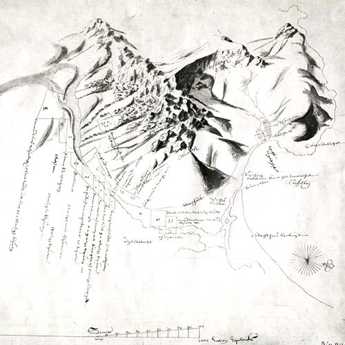
General plan of the European Reserve in the District of Port St. Johns, Pondoland. Sheet no. 1
-
Subject
-
Pondoland (South Africa)--History--Maps, Land use--South Africa--Pondoland, Pondoland (South Africa)--Description and travel--Maps,
-
Description
-
Plan of the European Reserve in the District of Port St. Johns, Pondoland, showing farmlands, names of places, forests, rivers, mountains, and main roads. Relief shown by shading. Some colours. Scale 100 Cape Roods to the inch.
-
Identifier
-
islandora:30086
-
-
Title
-
Map to accompany General Manager's report for year 1898
-
Subject
-
Railroads--South Africa--Maps,
-
Description
-
Map showing railways in the Cape Colony, the Orange Free State, the South African Republic, Bechuanaland and into Rhodesia, with administrative boundaries, place names and rivers. Some colour. Scale 1/8 inch to 10 miles.
-
Identifier
-
islandora:25130
-
-
Title
-
Sketch map of the country between the Kowie and the Chalumna Rivers showing the Fingo and Kafir locations, general lay of the country &c, &c
-
Subject
-
Geology -- South Africa -- Eastern Cape., Eastern Cape (South Africa) -- Maps.
-
Description
-
Map gives cadastral details including field-cornetcy boundaries and numbers, farm boundaries, farm names and the territories of leaders including Jokweni, Matomela, Kama, Kaulela, Toise, Siwani and Jali. Map also shows towns and villages including Bathurst, Clumber, Peddie and Hamburg., Projection not given. Coordinates not given., Annotated in blue pencil: "Recd from Mr. Henkel 9/1/77 H.E. Richard Bright."
-
Identifier
-
islandora:19617
-
-
Title
-
General plan of the diamond fields, to illustrate the Report of the Surveyor of Mines dated Feby. 28th 1883
-
Subject
-
Diamond mines and mining--South Africa--Northern Cape--Maps,
-
Description
-
Map showing the diamond mines around Kimberley and Beaconsfield, namely, Kimberley Mine, Old de Beer's Mine, Bultfontein Mine and Du Toit's Pan Mine, within the divisions of Alexanderfontein, Bultfontein, Vooruitzigt, Dorstfontein and Benauwheidfontein, with roads. Scale 1 inch to 20 chains.
-
Identifier
-
islandora:25122
-
-
Title
-
General correspondence
-
Subject
-
Royal Society of South Africa, Drennan, M. R. (Matthew Robertson), 1885-1965.
-
Description
-
Typed letter to Matthew Drennan on his election as a Fellow of the Royal Society of South Africa
-
Identifier
-
islandora:20962
-
-
Title
-
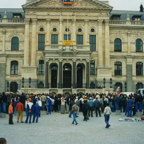
General Smuts, Cape Town, 1940
-
Subject
-
Cape Town (South Africa), Western Cape (South Africa), Apartheid, Politics, United Party (South Africa), Governments, World War, 1939-1945
-
Description
-
Prime Minister Jan Christiaan Smuts (centre front) with supporters outside Parliament, Cape Town, 1940
-
Identifier
-
islandora:16945
-
-
Title
-
Groot Constantia: general restoration
-
Subject
-
South Africa ; Western Cape, Province of the ; Cape Town, Wine estates, Groot Constantia (Cape Town, South Africa), Historic farms--South Africa--Cape Town--Design and plans, Historic farms--Conservation and restoration--South Africa--Cape Town, Wineries--South Africa--Cape Town--Design and plans, Landscape architecture--South Africa--Cape Town
-
Description
-
Sloot Details: hand-drawn pen and ink detail drawings on tracing paper, showing the hard landscaping construction details of the new stone-pitched sloots (reflection pools) running through the courtyard between the historic manor house and cellar buildings of the old farm werf at the historic Groot Constantia Wine Estate, Groot Constantia Road, Cape Town, South Africa. The details indicate the plan, sectional elevation, and detailed cross section of the sloot, giving dimensions and annotations specifying materials, finishes and fixings., Scale 1:50 on A1 Drawing number 301/WD/11 . Details No, 1 & 2 (Cross reference Dwg. No. 301/WD/01)
-
Identifier
-
islandora:22460
-
-
Title
-
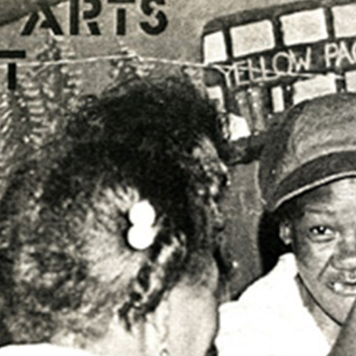
Community Arts Project : general report (February 1990)
-
Subject
-
Community Arts Project (Cape Town, South Africa), Community arts projects--South Africa--Cape Town
-
Description
-
Optimistic report outlining good prospects for the Community Arts Project. The report was written by Mike van Graan, shortly after the unbanning of political organisations, February 1990.
-
Identifier
-
islandora:19037
-
-
Title
-
Photograph of General Jan Smuts, Cape Town
-
Subject
-
Muizenberg (South Africa), Western Cape (South Africa), Politics, Apartheid
-
Description
-
Political fable: Muizenberg, 1980. This accidental arrangement of the flag and a picture of General Jan Smuts hang against a back wall of the Sawas Hall in Muizenberg, testimony to the sometimes strange fortunes of South African politics.
-
Identifier
-
islandora:18072
-
-
Title
-
North east part of Griqualand West. Plan E, Annexure to Report of Surveyor General dated 21 March 1881
-
Subject
-
Farms--South Africa--Griqualand West--Maps, Griqualand West (South Africa)--Maps, ,
-
Description
-
A map of the north-east part of Griqualand West showing farms held on title, provisional title and lease, crown land, commonage, native locations, farms surveyed and reported and farms surveyed but not yet reported. Relief shown by hachures. Place names: Kuruman and Taouns. Some colour. Scale 2 1/2 inches to 10 miles. Scale about 1/2 inch to 1000 Cape roods. [Coordinates estimated]
-
Identifier
-
islandora:25064
-
-
Title
-
Groot Constantia: general restoration
-
Subject
-
South Africa ; Western Cape, Province of the ; Cape Town, Wine estates, Groot Constantia (Cape Town, South Africa), Historic farms--South Africa--Cape Town--Design and plans, Historic farms--Conservation and restoration--South Africa--Cape Town, Wineries--South Africa--Cape Town--Design and plans, Landscape architecture--South Africa--Cape Town
-
Description
-
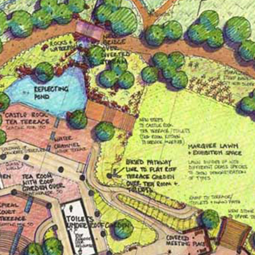
Working Drawing: following on from the previous sheet, this hand-drawn, landscape sketch plan drawing, using pen and ink on tracing paper, is part of a series of four sequential drawings showing the extent of hard and soft landscape intervention and restoration work to the historic avenue and farm werf of the Groot Contantia Estate, Groot Constantia Road, Cape Town, South Africa. This particular drawing shows the visitors entrance and orientation centre and Jonkershuis Restaurant complex. The drawing continues onto the next sheet., Scale 1:200 on A1 size. Drawing Number 301/WD/02. (series of four sequential drawings, including Dwg. No. 301/WD/03, 301/WD/02, 301/WD/01.)
-
Identifier
-
islandora:22450
-
-
Title
-
General plan of the European Reserve in the District of Port St. Johns, Pondoland. Sheet no. 2
-
Subject
-
Pondoland (South Africa)--History--Maps, Land use--South Africa--Pondoland, Pondoland (South Africa)--Description and travel--Maps,
-
Description
-
Plan of the European Reserve in the District of Port St. Johns, Pondoland, showing farmlands, names of places, forests, rivers, mountains, and main roads. Relief shown by shading. Some colours. Scale 100 Cape Roods to the inch.
-
Identifier
-
islandora:30101
-
-
Title
-
Groot Constantia: general restoration
-
Subject
-
South Africa ; Western Cape, Province of the ; Cape Town, Wine estates, Groot Constantia (Cape Town, South Africa), Historic farms--South Africa--Cape Town--Design and plans, Historic farms--Conservation and restoration--South Africa--Cape Town, Wineries--South Africa--Cape Town--Design and plans, Landscape architecture--South Africa--Cape Town
-
Description
-
Formal Garden - Planting Plan: this hand-drawn, technical working drawing, using pen and ink on tracing paper, shows the detailed planting plan of a proposed formal parterre garden, aligned on the side steps leading from the kitchen of the manor house of the historic Groot Contantia Wine Estate, Groot Constantia Road, Cape Town, South Africa. The drawing gives the plant species lists, planting out ratios and plant quantities., Scale 1:50 on A1 size. Drawing number 301/PP/05.
-
Identifier
-
islandora:22447
-
-
Title
-
Governor-General and wife at the opening of parliament, Cape Town
-
Subject
-
South Africa. Parliament, Governments, Armed forces, ,
-
Description
-
This was the big moment in the opening of Parliament ceremony today. As the Governor-General (Dr. E.G. Jansen) and Mrs Jansen arrive at the entrance gate the guard of honour presents arms, the 21-gun salute roars out across the city and the band strikes up "Die Stem". Dr. Jansen's aide de camp, Captain P. Roos, is at Mrs Jansen's side.
-
Identifier
-
islandora:15736
-
-
Title
-
Map to accopmany General Manager's report for year 1901
-
Subject
-
Railroads--South Africa--Maps, Railroads--Zimbabwe--Maps, Railroads--Botswana--Maps, , ,
-
Description
-
A map showing the railway lines in South Africa, Bechuanaland and Rhodesia, namely, the Western System, the Midland System, the Eastern System, the Imperial Military Railways in the Orange River Colony and the Transvaal, the Natal Railways and the Rhodesia Railways, with a few sections of foreign and other railways, as well as lines under construction. The map shows colonial boundaries, rivers and towns. Some colour. Scale 1/8 inch to 10 miles.
-
Identifier
-
islandora:25115
-
-
Title
-
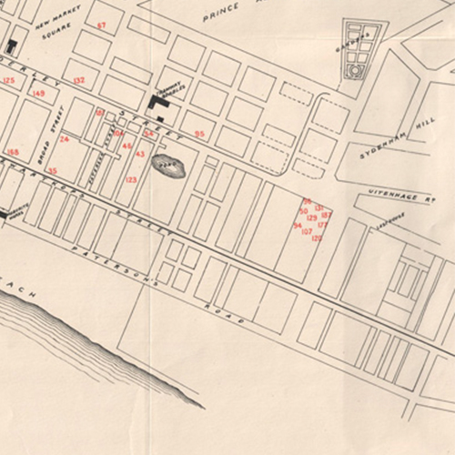
General Plan of the City of Bloemfontein
-
Subject
-
Bloemfontein (South Africa)--Maps, Free State (South Africa)--Maps,
-
Description
-
General plan of the City of Bloemfontein shows the central city area including plots, railway, roads, and a variety of notable landmark including the lunatic asylum, government buildings, recreational grounds, churches, the agricultural showground , Grey College and the Ramblers Club. The shaded relief indicates the nearby Naval Hill. Projection not given.
-
Identifier
-
islandora:30104
-
-
Title
-
Groot Constantia: general restoration
-
Subject
-
South Africa ; Western Cape, Province of the ; Cape Town, Wine estates, Groot Constantia (Cape Town, South Africa), Historic farms--South Africa--Cape Town--Design and plans, Historic farms--Conservation and restoration--South Africa--Cape Town, Wineries--South Africa--Cape Town--Design and plans, Landscape architecture--South Africa--Cape Town
-
Description
-
Alterations to Stairs at Bus Parking: this hand-drawn, technical working drawing, using pen and ink on tracing paper, shows the hard-landscape construction detail of an additional masonry plastered and painted 'werf' wall to an external staircase adjacent the historic farm werf of the Groot Constantia Wine Estate, Groot Constantia Road, Cape Town, South Africa. The drawing indicates the setting out, materials and dimensions in detail plan, long-section and typical cross section., Scale 1:25 and 1:10 on A1 size. Drawing number 301/WD/08. Detail No. 11. (Cross reference: Dwg. No. 301/WD/03)
-
Identifier
-
islandora:22445