
Search
525 items
-

[Afrique Equat Francaise, Soudan, Anglo Egyptien, Afrique Orientale Italienne, Congo Belge, Saoudienne]
Map showing northeast Africa with colonial territories including French Equatorial Africa, British Somalia, Anglo Egypt, Italian West Africa, Uganda and parts of Belgian Congo and Sudan, the Red Sea and Saudi Arabia, with administrative boundaries, state and political boundaries, and showing perennial and intermittent water courses, navigable canals, lakes, basins without drainage, marsh, bogs, sand, coastal points and important summits, railroads, international and other important, automotive routes, principal, international, secondary roads, principal and important paths, population density of towns, pipe lines, navigation routes, marine bases, aerononautical bases. Colour. Relief is shown in form lines and hypsometric tints. Scale 1 : 5.000.000. [Coordinates estimated]. -

[Afrique Occidentale Francaise]
Map showing the north-western coastal region of Africa covering French West Africa and the Gulf of Guinea and Including parts of Mauritania, Sudan, Portuguese Guinea, Sierra Leone, Liberia, Ivory Coast, Gold Coast, Togo, Nigeria, Cameroon, Spanish Guinea, and administrative boundaries, state and political boundaries, with perennial and intermittent water courses, navigable canals, lakes, basins without drainage, marsh, bogs, sand, coastal points and important summits, international and other important railways, roads, principal, international, secondary routes, principal and important paths, population density of towns, pipe lines, navigation routes, marine bases, aerononautical bases. Relief is shown in form lines and hypsometric tints. Gauss Conform projection. Colour. Scale 1 : 5.000.000. [Coordinates estimated] -

[Basutoland, East Griqualand, Pondoland]
A map of the Eastern Cape, East Griquland and Basutoland showing tribal territories, with part of Natal and the Aliwal North and Wodehouse Districts of the Cape Colony. The map shows rivers, boundaries, roads, police camps and palce names. Relief is shown by hachures. Chiefly colour. No scale given. [Coordinates estimated] -

[Map of Swaziland]. Swaziland south
Map showing the territorial and district boundaries, native areas, rights of way, main roads and paths, footpaths, police posts, post offices, post and telegraph offices, telegraph lines, mission stations, stores, homesteads and mines, "kaffer kraals," railway stations. Relief shown by hill shading. Colour. Scale 1 inch to 1000 Cape roods. Scale 1 inch to 2.347 English miles. [Coordinates estimated] -

[Map of the Union of South Africa. Sheet 1 of 4]
Map showing northern part of the Cape Province of the Union of South Africa, South West Africa and part of the Bechuanaland Protectorate, with towns and villages, roads, railways, rivers, native reserves, crown reserves, police reserves, game reserves, churches, lighthouses, salt pans, vleis. Some colour. No scale given. -

[Map of the Union of South Africa. Sheet 2 of 4]
Map showing the Transvaal Province of the Union of South Africa, part of the Orange Free State Province, Swaziland, part of the Bechuanaland Protectorate and the borders with Rhodesia and Mozambique, with district boundaries, cities, towns and villages, roads, railways, rivers, native reserves and locations, crown reserves, lakes, mines, mountains and hills. Some colour. No scale given. -

[Postal communications : Union of South Africa, 1937 = Posverbindings : Unie van Suid -Afrika, 1937.]
South eastern sheet map showing the postal routes and post offices, with provincial and magisterial district boundaries, railways, roads, district towns and villages, irrigation works, boreholes, lighthouses, wireless stations, aerodromes and aircraft radio stations. Includes an inset of the Cape Peninsula. Some colour. Scale 1 inch to 15.77 miles. [Coordinates estimated] -

Abẻchẻ
Map showing Abẻchẻ in Chad, with international and intercolonial borders, place names, swamps, rivers and sand. Relief shown pictorially and by contours. 3rd edition. Some colour. Scale 1 : 1 000 000. -

Abidjan
Map showing Abidjan region in Ivory Coast, including Agboville, Lakota and Aboisso and the Atlantic coast, and state boundaries, colonial territories, provincial, district and subdivision boundaries, with railway, roads, tracks, paths, streets with telegraph lines and telegraph lines, colonial capitals, important cities and main towns, chief towns of districts, bridges, ferries, ford crossings, perennial and intermittent water flows, swamps, springs, salt or sweetwater marshes, airports, landing strips and water airports, post and telegraph offices,roadhouses, radio stations, customs offices, military bases, stage and storage camps, Christian missions, Mosques, minarets, sacred places, trigometric or astronomic points, coastal harbours, forest (high and jungle). Altitude in metres. Relief is shown in form lines. Colour. Special edition. Scale 1 : 500 000. -

Abyssinia
Map showing Abyssinia, now Ethiopia, and international, intercolonial, provincial, district boundaries, with place names, railways, with gauge in metres written along the line, under construction, projected, roads suitable for motor traffic, suitable for carts, tracks, telegraphs or telephones, telegraphs or telephones along roads or tracks, boundaries: names of: provinces, frontier districts, localities, mountain ranges, peaks, valleys, capes, islands, tribes, towns of 1st, 2nd, 3rd, 4th and 5th importance, rivers, unsurveyed, canals, marshes and swamps, plains liable to inundation, contours are at 200 & 500 metres & thence at 500 metre interval, geodetic trigonometrical stations, altitudes in metres, depths in metres, well, springs, waterholes, pools, historical ruins, wireless telegraph stations, limits of navigation, scale of nautical miles, list of authorities, conversion table from metres to feet, altitude tint chart, key to magnetic variation, key to relative reliabitlity, reference to air information. Relief shown by form lines, hachures, tinted shading, height in metres. Colour 3rd edition. Scale 1 : ,2000 000. -

Afrique du nord (est)
Map showing the border regions of Libya, Tunisia and Tripolitaine (Libya), and international boundaries, French frontier zones and prohibited zones, with aerodromes, seaplane ports, airship hangars and aeroplane hangars, balloon inflation stations, customs offices, mooring berths, aeronautical points, lighthouses, meteorological stations, radiogoniometric stations, radio-telephonic stations, aerodrome stations with seaplane ports, aerodromes with aerial light houses, aerodromes with all services, roads, rails, rivers, lakes, sand, coastal points. Inserts show seaplane ports in Alger, Bizerte and Oran. Relief is shown in form lines. Colour. Mercator projection. Scale 1 : 3.216.400. [Coordinates estimated] -

Afrique Est
Map showing East Africa, including Abyssinia, Kenya Tanganyika, Belgian Congo, Equatorial France and parts of Egypt and colonial boundaries and administrative divisions,with towns and administrative centres, important indigenous centres, main military posts, historical ruins, railways, principal Saharan routes, rivers and streams, lakes, stagnant water, swamps, important water sources, rocks and dunes. Colour. Relief is shown by form lines, hatchures and hill shading. Scale 1 : 5.000.000. [Coordinates estimated] -

Afrique Nord-Est
Map showing north east Africa, including Egypt, Libya, Eritrea, the British Sudan and Chad, and the regions around the Mediterrenean and Red Sea, including the Arabian Peninsula, Iran, Yemen, Transjordan, Palestine and the French Levant, and colonial boundaries and administrative divisions. Map shows towns and important indigenous centres, main military posts, historical ruins, railways, principal Saharan routes, rivers and streams, lakes, stagnant water, swamps, important water sources, rocks and dunes. Colour. Relief is shown in form lines, hatchures and hill shading. Scale 1 : 5.000.000. [Coordinates estimated] -

Afrique Nord-Ouest
Map showing North West Africa including Senegal, Gambia, Mauritania, Spanish Sahara, Morocco and Algeria, Tunisia, Senegal, and parts of Libya and Niger, and colonial boundaries and administrative divisions, with towns and important indigenous centres, main military posts, historical ruins, railways, principal Saharan routes, rivers and streams, lakes, stagnant water, swamps, important water sources, rocks and dunes. Colour. Relief is shown in form lines, hatchures and hill shading. Scale 1 : 5.000.000. [Coordinates estimated] -

Afrique Ouest
Map showing the West African coast including Portuguese Guinea, French Guinea, Sierra Leone, Liberia, Ivory Coast, Gold Coast, Togo, Dahomey, Nigeria, Cameroon, Spanish Guinea and Gabon, and colonial boundaries and administrative divisions, with towns and important indigenous centres, main military posts, historical ruins, railways, principal Saharan routes, rivers and streams, lakes, stagnant water, swamps, important water points, rocks and dunes. Colour. Relief is shown by form lines, hatchures and hill shading. Scale 1 : 5.000.000. [Coordinates estimated] -

Afrique Sud
Map showing southern Africa, including Angola, Northern and Southern Rhodesia, South West Africa, Bechuanaland, Mozambique and the Union of South Africa, and colonial boundaries and administrative divisions, with towns and important indigenous centres, main military posts, historical ruins, railways, principal Saharan routes, rivers and streams, lakes, stagnant water, swamps, important water points, rocks and dunes. Colour. Relief is shown in form lines, hatchures and hill shading. Scale 1 : 5.000.000. -

Agades
Map showing Agades In Niger, with international, intercolonial, provincial and district borders. It also shows towns, contours, swamps, rivers with falls, sandy deserts, canals, lakes salt lakes, low ground liable to temporary floods, marsh, oasis, railways, railways under construction, metalled roads, all weather motor roads, seasonal roads, other tracks paths or explorers routes, telegraph and telephone lines along roads and tracks, post offices, wireless telegraph stations, mosques, lighthouses, ruins, water points, wells, mines and quaries trig points, heights in metres and depths in metres. 3rd edition. Relief shown by form lines. Colour. Scale 1 : 1 000 000. -

Agadés
Map showing Agadés in northern Niger, with relief shown by form lines and hachures, towns, rivers, roads and boundaries. Names of regions shown: Aïr, Lak, Azbine, Dagades, the Ténéré region of the Saharan Desert. 3rd edition. Colour. Scale 1:1 000 000. -

Agades
A map of Agades, in Niger, showing district boundaries, with desert trail routes, tracks, paths, routes of explorers, villages and towns, flight and landing fields, astronomical points, radio stations, rivers, wells, water sources, mountains, natural watering holes in the rocks, excavated watering holes, mostly in gravel. Relief shown by form lines. Colour. Special edition VII. Scale 1 : 500 000. -

Agellal
Map showing Agellal in Niger, and intercolonial or mandate, provincial and district boundaries, with desert tracks or paths, passable all year round roads and ways for motor traffic, heavy duty roads, light duty roads, nature paths, passable all year round, small towns, villages, flight and landing strips, astronomical points, radio or transmission stations. Relief shown by form lines. Colour. Special edition VII. Scale 1 : 500 000. -

Agro-ecological survey of Southern Rhodesia natural regions and areas and related farming systems
Map of Southern Rhodesia showing natural areas and related farming systems including intensive livestock production, diversified production, intensive grain crop production, intensive crop production, intensive mixed farming, intensive diversified farming, intensive livestock production supported by crop production, semi-intensive beef or livestock production, afforestation, semi-extensive livestock and beef production, forestry, unsuitable for any form of agricultural utilisation, suitable only for nature reserves, with towns and other place names, district boundaries, rivers, water resources, national parks, mines, roads, railways and churches. Colour. Relief shown by spot heights. Scale 1 : 1,000,000. -

Agro-economic survey of Southern Rhodesia economic regions and areas showing the present European farming pattern
Map of Southern Rhodesia showing agro-economic areas and farming patterns of forestry, beef production, maize farming,irrigation farming, tobacco, cattle maize and other crops, tobacco and cattle production, cattle production, cattle ranching, with provincial and district boundaries, native reserves and native purchase areas, special native areas and forest areas or reserves and undertermined areas, railways, roads, towns and other place names. Colour. Scale 1 : 1,000,000. -

Aïn-Sefra
Map showing Aïn-Sefra in Naâma Province, Algeria and part of Morocco, and national, military territory anddistrict boundaries, with metalled roads normal routes, metalled roads narrow paths, tramways, in construction, main roads, secondary roads, regularly maintained. paths, trails, perennial rivers/watercourses, non-perennial rivers/watercourses, ravines, aqueducts, wells: source, marsh, capital city, capital towns of districts, villages, hamlets, centre of colonisation, reinforced towers, churches, chapels, mosques, ruins, mines, lighthouses, places by number of inhabitants, isolated places, uninhabitated places, state forests, palm trees. Relief shown by form lines and shading. Colour. Scale 1: 500 000. -

Aïne Djeloula
Map of the region surrounding Aïne Djeloula in Kairouan governorate in Tunisia,showing state, department, district and town boundaries, with magnetic declination, long distance roads, communication routes, local highways, irregularly maintained dirt roads, logging roads and mule tracks, remains of Roman roads, stone bridges, suspended bridgse with support, footbridges, ferries, fords navigable by vehicle or foot, forests, marshes, dunes, vines, water sources dry in summer, churches, chapesl or holy places, houses, wells and fountains, water and wind mills, fixed and rotating lighthouses, port lights, cannons, cemetries, irrigation canals, trigonometric points, telegraphs, posts. Relief shown by form lines and hill shading. Colour. Scale 1 : 50,000. -

Aldabra
Map showing Aldabra, the world's second largest coral atoll situated in the Aldabra Group of islands in the Indian Ocean that form part of the Outer Islands of the Seychelles, with place names, heights in metres, scale of nautical miles, coral reefs, roads, altitudes in metres, lighthouses. Relief shown by height in metres. Colour. First edition. Scale 1 : 2,000 000. -

Alexandria
Map showing large city, villages, important villages telegraph roads, wireless telegraph stations and landing grounds for aeroplanes. Railways, main roads, paths and tracks, boundaries,international and provincial, canals, streams, marsh, salt, palms, scrub, water, perennial, heights, contours, sand dunes, tombs and sheikh's tombs and ruins. Scale 1:1,000,000 -

Alger
Map showing Alger in the north of Algeria and the Islands of Ibiza and Mallorca, with single railways, narrow gauge railways, railways under construction. 1st and 2nd class roads for wheel traffic, paths or tracks, rivers and streams, perennial and sometimes dry, boundaries of counties, towns, lighthouses, contours, heights above and below sea level in metres. Colour. Scale 1:1,000,000. -

Alger
Map showing Alger, and the Alger bay area in northern Algeria, and national, military, district and town boundaries, with railways, tramways, tracks, major and secondary roads, camel paths, intermittent water sources, ravines, perennial water sources, aqueducts, wells, marshes, capitals, important towns, districts under chieftainship, fully functioning communities, colonial centres, hamlets, fortified towns, churches, mosques, ruins, mines, lighthouses, curvature, common boundaries, forests, olive groves and population levels. Relief is shown using form lines, contours and hill shading. Colour. Scale 1 : 500.000. -

Alger
Map with hypsometric tints showing Alger and the Alger bay area in northern Algeria, using the Southern Zone Layer System for altitudes, with railways, roads, place names. Relief shown by form lines, heights in metres. Colour. Scale about 1 inch to 10 miles. -

Alger-Laghouat
Map showing the major cities, roads, place names and the rivers of Algeria, including the Laghouat Province. Demarcated boundaries drawn in pink. Relief shown by shading. Colour. Scale 1:1,000,000 -

Algérie
Map showing Algeria, a country in the Maghreb region of North Africa on the Mediterranean coast, and international, international undemarcated, intercolonial, provincial, frontier district boundaries, with towns of 1st, 2nd, 3rd, 4th and 5th importance, rivers, unsurveyed water courses, canals, marshes, ground liable to flooding, railways with gauge and number of tracks, railways under construction, with single tracks, with narrow gauge, metalled roads, secondary roads, other tracks, paths or explorers routes, provinces, frontier districts, localities, mountain ranges, peaks, valleys, capes, islands, tribes, regions, key to method of giving a position reference, list of abbreviations, references: trigonometrical points, height in metres, depth in metres, water points, ruins of historical interst, wireless stations, landing ground, mines or quarries, lighthouses, fortified houses or towers, oases, camps, rest houses, petrol depots, chief post of Cie Saharienne, advanced post of Cie Saharienne. Relief shown by form lines, hachures, shading, height in metres. Colour. Second edition, ground/air. Scale 1 : 2,000 000. -

Alula
Map of Alula and surrounding areas on the tip of the Horn of Africa along the Gulf of Aden and the Indian Ocean coast, showing territorial boundaries, with railways, principal and other roads, tracks, principal towns, centres and administrative posts, villages, settlements, missions, tribal or area names, localities, post offices, post and telegraph stations, telegraph or telephone lines, power and transmission lines, lighthouses, rivers and watercourses, springs, waterholes, wells, swamps, contours, hill features, cliffs and escarpment, craters, altitude in metres, altitude in feet, triangulation and astronomical stations, lava and lava boulders, sand, airfields, landing grounds, flying boat bases and alighting areas, isogonal, marine lights, lightships, obstructions and group obstructions, international boundaries closed to passage of aircraft, except through air corridors, prohibited areas, dangerous or restricted areas. Colour. Relief shown by form lines and altitude tints. First edition. Scale 1 : 1,000,000. -

Ambositra
Map showing Ambositra, in western Madagascar, with paved and unpaved roads, roads for carts/wagons, mule driver paths, trails or tracks, bridges/decks of iron, stone, wood, unsurveyed roads, geodetic signals, key junctions, names of mountains, extractions, boulders, rocky escarpments, large villages, villages, houses: masonry and earthen, churches: masonry and earthen, tombs, wells/springs, wet or covered sands, dry sands, bush, high bush, marsh, rice paddies, plantations, parks, orchards, palm trees, mangroves, baobabs, isolated trees. Relief shown by form lines. Colour. Scale 1:100 000. [Coordinates estimated]. -

Amguid : Inifel
Map showing the Amguid region in Algeria and territorial and district boundaries, with tracks, major and secondary roads, perennial and intermittent water sources, filled wells, depth of wells in metres ,rock and saltflats, dunes, rimstone pools, fortresses, shrines, post and telegraph stations, geodetic and astronomic points, escarpment, dune and cavities, landing strips, palms, forests, shrubs and permanent pasture. Relief is shown in hatchures, form, contour lines and spot heights. Colour. Scale 1 : 500.000. -
Ansongo
Map showing Ansongo, a rural commune and small town in the Gao region of eastern Mali alongside the Niger river, and international, intercolonial or mandate, provincial, district and subdivision boundaries, with roads and ways for motor traffic, heavy duty roads, light duty roads, nature paths, passable all year round, passable only in dry weather, roads under construction, other tracks paths or explorers' routes, telegraph lines along roads, telegraph lines, capital of the colony, important city districts, city subdivisions, villages, district capital, bridges, ferries, fords, perrenial rivers: with canals, non-perennial, unsurveyed, swamps, wells, waterholes, ground liable to flooding, airpoirts, flight and landing strip, water airports, post offices and post offices with telegraph or telephones, roadhouses, radio or transmission stations, lighthouses, customs offices, harbours, Christian missions, trigonometric or astronomical points. Relief shown by form lines, heights in metres. Colour. Special edition. Scale 1 : 500 000. -

Antsalova
Map showing Antsalova, a town and commune in western Madagascar, with roads for carts/wagons, mule driver paths, tracks, bridges/decks, telegraph offices, geodetic points, side points, chief places of subdivisions, chief places of the canton, villages, springs/wells/watersources, woods, boulders/large rounded rocks, tombs, churches, rice paddy fields, marsh, bush, scrublands, palm trees. Relief shown by countours and hachures. [Coordinates estimated]. Colour. Scale 1 : 100 000. -

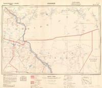
Appendix map C
Map showing the territory of Nicholas Waterboer in Griqualand West, in relation to the Cape Colony and the Orange Free State, with the boundaries according to treaties, rivers, place names and relief shown by hachures. No scale given. -

Appendix map C
Map showing the territory of Nicholas Waterboer in Griqualand West, in relation to the Cape Colony and the Orange Free State, with the boundaries according to treaties, rivers, place names and relief shown by hachures. No scale given. -

Arauan
Map of Arauan, in Mali, showing national, colonial and district boundaries, with roads, waterholes, swamps, flooded areas, sand dunes, salt marsh, mountains, villages, cemeteries and graves, ruins, post offices and telegraph lines, radio stations, customs offices, landing fields, boabab and palm trees. Relief shown by hachures and shading. Special edition V. Scale 1 : 500 000. [Coordinates estimated]. -

Ariana
Map of Ariana and surrounding region in north-eastern Tunisia with Djebel Amar and Henchi Sidi Athman, showing state, administrative, district and town boundaries, with magnetic declination, long distance roads, communication routes, local highways, irregularly maintained dirt roads, logging roads and mule tracks, remains of Roman roads, stone bridges, suspended bridges with supports, footbridges, ferries, fords navigable by vehicle or foot, forests, marshes, dunes, vines, water sources dry in summer, churches, chapels or holy places, houses, wells and fountains, water and wind mills, fixed and rotating lighthouses, port lights, redoubts, batteries, cemetries, irrigation canals, trigonometric points, telegraphs, posts. Colour. Relief in hill shading and form lines and contours. Scale 1 : 50.000. -

Atar
Map showing Atar, a town and capital of the Adrar Region in northwestern Mauritania, and state, colonial, district and subdivision boundaries, with roads and ways for motor traffic, heavy duty roads, light duty roads, other tracks or paths, post offices and post offices with telegraph or telephones, telegraph lines, radio or broadcast stations, customs offices, flight and landing strips, astronomical points, permanent water points with depth in metres, temporary water points, salt water marshes, swamps, marsh, wells, dunes, sand, basin with sandy base, island or board mountains, level, steep edges, realative heights: steep slopes and dunes, altitude with height in metres, ruins, reinforced towers, cemetries, graves, palms, trees, baobabs, pastures, Relief shown by form lines, shading and hachures. Special edition VI. Scale 1 : 500 000. -

Azazga
Map showing the town of Azazga in the Tizi Ouzou Province in northern Algeria, and state, department, district and town boundaries, with national highways, department roads, irregularly maintained carriage roads, paths, logging roads and mule tracks, remains of Roman roads, railways, bridges, ferries, fords, woods, marshes, dunes and sand, vines, water sources dry in summer, churches, chapels and holy places, houses, wells and fountains, water and wind mills, irrigation canals, fixed and rotating lighthouses, port lights, redoubts, batteries, cemetries, trigonometric points, telegraphs, posts. Colour. Relief in hill shading and form lines and contours. Scale 1 : 50.000. -

Bahr El 'Arab
Map showing the river Bahr el 'Arab which forms part of the border between South Sudan and Sudan, withtowns, villages, boundaries, international, demarcated, provincial, district, game reserve, main roads, secondary roads, paths or tracks, telegraphs along roads, post and telegraph offices, telephone posts, landing ground for aeroplanes, Qubba, Christian missions, rest houses, floatplane beaches, tribal names, districts, localities, jebels, contours, heights in metres above mean sea level, rivers, perennial, sometimes dry, unsurveyed, water, perennial, temporary, marsh, trigonometrical or astronomical points, battle-fields, rivers, wells, pools, lakes or swamps, an abode or country, low clay mounds, Dinka cattle camps, temporary camps, water holes or ponds, islands, depressions, waterholes, stones, rocks, wells, hills or mountains, dry water courses, ports, anchorages, shallow lagoons usually formed in swamps, landing places, cattle enclosures, bluffs, flat topped hills, water holes in rocks, sand ridges, tomb of a religious man, lakes, streams filled from rivers and running inland, capes, small streams, running streams, large crack in cotton soil holding water, chief, markets, waterholes, dry water courses generally wider than a khor, outcrop of rocks. Relief shown by contours. Colour. Scale 1: 1 000 000. -

Bahr El Ghazal
Map showing Bahr el Ghazal, a region of western South Sudan, and international, intercolonial, provincial, district boundaries, with place names, railways, under construction, projected, roads suitable for motor traffic, suitable for carts, tracks, telegraphs or telephones, telegraphs or telephones along roads or tracks, provinces, frontier districts, localities, mountain ranges, peaks, valleys, capes, islands, tribes, towns of 1st, 2nd, 3rd, 4th and 5th importance, rivers, unsurveyed, canals, marshes and swamps, plains liable to inundation, geodetic trigonometrical stations, altitudes in metres, depths in metres, wells, springs, waterholes, pools, historical ruins, wireless telegraph stations, limits of navigation, scale of nautical miles, land aerodromes, landing fields, airship bases, airship hangars, airship mooring masts, water aerodromes, seaplane moorings or anchorages, marine lights: lighthouses or light buoys, light vessels (centre of star, air lights, radio electric stations, aeronautical radio D/F or radio beacon stations, overhead hight tension cables, landmarks, air corridors (not marked on this sheet), danger areas, explosives areas, airports (with customs facilities) land and water aerodromes with air light. aeronautical radio communication stations and D/F or radio beacon stations, landing grounds abandoned. Contours are at 200 & 500 metres & thence at 500 metre intervals. Relief shown by form lines with height in metres, tinted shading. Colour. Scale 1 : 2,000,000. -

Bamako
Map showing the Bamako district in Mali, with place names, roads, railroads, railroad stations, telegraph and telephone lines, post offices with telegraphs or telephones, other tracks paths or explorers routes, lakes, salt lakes, rivers, non-perennial rivers, intercolonial or mandate and district boundaries highlighted in pink. Relief shown by contours with height in metres. Colour. Scale 1: 1 000 000. -

Bathurst
Map showing Banjul, formely known as Bathurst, the capital city of The Gambia, and country, intercolonial or mandate, provincial, and district boundaries, with place names, roads and ways for motor traffic, heavy duty roads, light duty roads, nature paths, passable all year round, passable only in dry weather, other tracks, paths or explore'rs routes, telegraph lines along roads, telegraph lines, capital of the colony, important city districts, city subdivisions, villages, district capitals, bridges, ferries, fords, perrenial rivers: with canals, non-perennial, unsurveyed, swamps, wells, waterholes, ground liable to flooding, airports, flight and landing strips, water airports, post offices and post offices with telegraph or telephones, roadhouses, radio or transmission stations, lighthouses, customs offices, harbours, Christian missions, mosques, minarets, sanctuaries, trigonometric or astronomical points with heights in metres, highest formlines, formlines not measured, seaports, forests, most frequently used abbreviations. Colour. Special edition VI. Scale 1 : 500 000. -

Béja
Map of Beja City and the mountaineous region northeast to it in the Bajah Governate of Tunisia, showing state, administrative, district and town boundaries, with magnetic declination, long distance roads, communication routes, local highways, irregularly maintained dirt roads, logging roads and mule tracks, remains of Roman roads, stone bridges, suspended bridges with supports, footbridges, ferries, fords navigable by vehicle or foot, forests, marshes, dunes, vines, water sources dry in summer, churches, chapels or holy places, houses, wells and fountains, water and wind mills, fixed and rotating lighthouses, port lights, redoubts, batteries, cemetries, irrigation canals, trigonometric points, telegraphs, posts. Colour. Relief in hill shading and form lines and contours. Scale 1 : 50.000. -

Bekopaka
Map showing Bekopaka, a town and commune in western Madagascar, with unpaved roads, mule driver paths, tracks, wooden bridges, geodetic signals, key junctions, earthen houses, large villages, villages, high bush, rice paddies, marsh, bush isolated trees, wet or covered sands, curves, springs, names of mountains, extractions, boulders, rocky escarpments, boulders. Relief shown by form lines. Colour. Scale 1 : 100.000. [Coordinates estimated]. -

Bemolanga
Map showing Bemolanga, a large oil sands deposit in the onshore Morondava Basin of Madagascar, with roads for carts/wagons, mule driver paths, tracks, drafted travelled roads, geodetic points, side points, large villages, villages, bridges/decks, mines, tombs, rice paddies of valley, bush, marsh, palm trees. Relief shown by countours and hachures. [Coordinates estimated]. Colour. Scale 1 : 100 000. -

Benguela
Map showing Benguela, a city in western Angola, and northern South West Africa, and international, intercolonial, provincial, district boundaries, with place names, railways, under construction, projected, roads suitable for motor traffic: all seasons, dry weather, motor tracks, tracks, telegraphs or telephones, telegraphs or telephones along roads or tracks, provinces, frontier districts, localities, mountain ranges, peaks, valleys, capes, islands, tribes, bridges, towns of 1st, 2nd, 3rd, 4th and 5th importance, rivers, unsurveyed, canals, marshes and swamps, plains liable to inundation, geodetic trigonometrical stations, altitudes in metres, depths in metres, welsl, springs, waterholes, pools, historical ruins, wireless telegraph stations, limits of navigation, mission stations. Contours are at 200 & 500 metres & thence at 500 metre intervals. Relief shown by form lines with height in metres, tinted shading. Second edition, ground/air. Colour. Scale 1 : 2,000,000.
