
Search
525 items
-
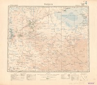
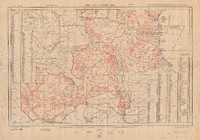
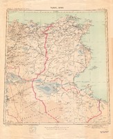
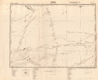
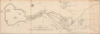
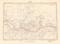
Tozeur
Map showing Tozeur, an oasis and city in south west Tunisia, and national, military territory and district boundaries, with metalled roads normal routes, metalled roads narrow paths, tramways, in construction, main roads, secondary roads, regularly maintained. paths, trails, perennial rivers/watercourses, non-perennial rivers/watercourses, ravines, aqueducts, wells: source, marsh, capital city, capital towns of districts, villages, hamlets, center of colonization, tower: reinforced, churches, chapels, mosques, ruins, mines, lighthouses, places by number of inhabitants, isolated places, uninhabitated places, palm trees. Relief shown by form lines and shading. Colour. Scale 1: 500 000. -
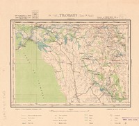
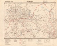
Trangahy
Map showing Trangahy, a town and commune in the Antsalova district, Mahajanga province, in western Madagascar, with roads for carts/wagons, mule driver paths, tracks, wooden bridges, wells, springs, geodetic points, key junctions, tombs, large villages, villages, wet or covered sands, dry sands, rice paddies, plantations, high bush, extractions, rocky escarpments, baobabs, coconut palms, bush, marsh. Relief shown by form lines. Colour. Scale 1 : 100.000. [Coordinates estimated]. -
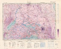
Transvaal
Map showing a province in the north of South Africa which was named Transvaal from 1910 until the end of 1994, and international, intercolonial, provincial, district boundaries, with place names, railways, under construction, projected, roads suitable for motor traffic: all seasons, dry weather, roads suitable for carts, tracks, telegraphs or telephones, telegraphs or telephones along roads or tracks, provinces, frontier districts, localities, mountain ranges, peaks, valleys, capes, islands, tribes, towns of 1st, 2nd, 3rd, 4th and 5th importance, rivers, unsurveyed, canals, marshes and swamps, plains liable to inundation, geodetic trigonometrical stations, altitudes in metres, depths in metres, wells, springs, waterholes, pools, historical ruins, wireless telegraph stations. Contours are at 200 & 500 metres & thence at 500 metre intervals. Relief shown by form lines with height in metres, tinted shading. Third edition, ground/air. Colour. Scale 1 : 2,000,000. -
Tribal map of eastern Africa
Map of east Africa showing the territories of the tribes of Sudan, Uganda, Abyssinia, Kenya, Somalia and British Somaliland, extending into Ruanda and Urundi, with capitals of territories, principal towns, localities or villages, rivers and railways. The map also shows parts of the neighbouring Anglo- Egyptian Sudan. Some colour. Relief shown by form lines and hachures. First edition. Scale 1 : 3.000.000. -
Tribal map of eastern Africa
Map of east Africa, showing the territories of the tribes of Northern Rhodesia, Nyasaland and Tanganyika, with capitals of territories, principal towns, localities or villages, rivers and railways. The map also shows parts of the neighbouring countries of Angola, Belgian Congo and Mozambique. Some colour. Relief shown by form lines and hachures. First edition. Scale 1 : 3.000.000. -
Tschad
Map of Chad showing radio stations, airports, landing fields, harbours, mines, lighthouses, channels, waterfalls, rivers, swamps, wells, sandy areas, seaports, height in meters, railways, highways, international, colonial, provincial and district boundaries, towns, post offices, telegraph lines, telegraph lines along the roads. Relief shown pictorially and with form lines. Some colour. Scale 1 : 1 000 000 -
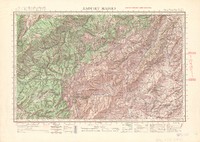
Tsianaloka
Map showing Tsianaloka, a region in Madagascar, with roads for carts/wagons, mule driver paths, trails or paths, large villages, villages, geodetic points, key junctions, churches, walks, tombs, bush, high bush, rice paddies, marsh, parks, wet or covered sands, dry sands, palm trees, isolated trees, banana trees, wells, springs, names of mountains, extractions, boulders, rocky escarpments. Relief shown by form lines. Colour. Scale 1 : 100.000. [Coordinates estimated] -
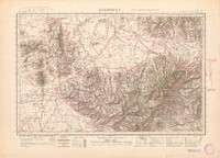
Tsiandro
Map showing Tsiandro, in western Madagascar, with paved and unpaved roads, roads for carts/wagons, mule driver paths, trails or tracks, bridges/decks of iron, stone, wood, unsurveyed roads, geodetic signals, key junctions, names of mountains, extractions, boulders, rocky escarpments, large villages, villages, houses ofmasonry and earth, churches of masonry and earth, tombs, wells/springs, wet or covered sands, dry sands, bush, high bush, marsh, rice paddies, plantations, parks, orchards, palm trees, mangroves, baobabs, isolated trees. Relief shown by form lines. Colour. Scale 1 : 100.000. [Coordinates estimated]. -
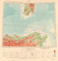
Tunis
Map showing Tunis in Tunisia and the south of Italy, with single railways, narrow gauge railways, railways under construction. 1st and 2nd class roads for wheel traffic, paths or tracks, rivers and streams, perennial and some times dry, international boundaries, lighthouse and large sea ports and wireless telegraph station, towns, mines, ruins, contours, heights above and below sea level in metres. Colour. Scale 1:1,000,000 -
Tunis
Map with hypsometric tints showing Tunis, in the Gulf of Tunis in Tunisia, using the Southern Zone Layer System for altitudes, with railways, roads, place names. Relief shown by form lines, heights in metres. Colour. Scale about 1 inch to 10 miles. -
Tunis
Map of Tunis, the capital of Tunisia, and surrounding areas including Sebkret Es Sedjoumi, Casbah, Lac de Tunis, Djebeida and Massicault, and state, administrative, district and town boundaries, with magnetic declination, long distance roads, communication routes, local highways, irregularly maintained dirt roads, logging roads and mule tracks, remains of Roman roads, stone bridges, suspended bridges with supports, footbridges, ferries, fords navigable by vehicle or foot, forests, marshes, dunes, vines, water sources dry in summer, churches, chapels or holy places, houses, wells and fountains, water and wind mills, fixed and rotating lighthouses, port lights, redoubts or redouts, batteries, cemetries, irrigation canals, trigonometric points, telegraphs, posts. Colour. Relief in hill shading and form lines and contours. Scale 1 : 50.000. -
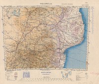
Tunis-Sfax
Map showing the poisition of Sfax, the major cities, place names, roads network and the rivers of Tunisia. Relief shown by shading. Demarcated boundaries highlighted in pink. Colour. Scale1:1,000,000 -
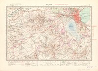
Turin
Map showing Turin, and state, colonial, district and subdivision boundaries, with roads and ways for motor traffic, heavy duty roads, light duty roads, other tracks or paths, post offices and post offices with telegraph or telephones, telegraph lines, radio or broadcast stations, customs offices, flight and landing strips, astronomical points, permanent water points with depth in metres, temporary water points, salt water marshes, swamps, marsh, wells, dunes, sand, basin with sandy base, island or board mountains, level steep edges, relative heights: steep slopes and dunes, altitude with height in metres, ruins, reinforced towers, cemetries, graves, palms, trees, baobabs, pastures, astronomical points. Relief shown by form lines, shading and hachures. Special edition VI. Scale 1 : 500 000. -
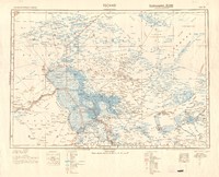
Uganda
Map of Uganda and surrounding region including Lake Victoria, showing territorial boundaries, with railways, roads, tracks, principal towns, centres and administrative posts, villages, settlements, missions, tribal or area names, localities, post offices, post and telegraph offices, telegraph or telephone lines, power transmission lines, rivers and watercourses, springs, waterholes, wells, swamps, contours, hill features, cliffs and escarpment, craters, triangulation and astronomical stations, lava and lava boulders, sand, airfields, landing grounds, seaplane stations, seaplane alighting areas. Colour. relief shown by form lines. Second edition. Scale 1:1,000,000. -
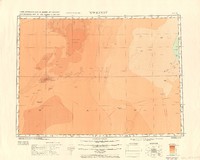
Uweinat
Map showing the 'Uweinat mountains on the border between Libya, Egypt and Sudan, with paths or tracks, explorers' routes, international and provincial boundaries, contours, sand dunes, Sheikhs' tombs. Heights shown by shading. Colour. Scale 1: 1,000,000. -
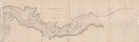
Van Stadens Road progress plan to 31 Decr. 1865, accompanying annual report
Relief map showing physical features and work to be done building the Van Staden road to Port Elizabeth, connecting with the old Cape Road. Scale: 1 inch to 250 English feet -
Van Wyk's Vley, January 1887: plan A
A map of Van Wyk's Vley showing the main dam in detail with furrows and natural watercourses, irrigable lands, roads and relief shown by contours and hachures. Scale 1 inch to 100 Cape roods. Scale 1/2 inch to 1 mile. -
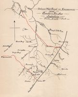
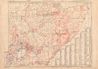
Victoria West Road - Carnarvon and Prieska - De Aar inspections
A map of proposed extensions of the raiway line in the Northern Cape, with rivers and place names. Some colour. Scale 1 inch to 16 miles. -
Voi, zone H
Map showing Voi, the largest town in Taita-Taveta County in southern Kenya, andinter-territorialboundaries, with place names, railways, light railways, roads, principal, other, tracks suitable for motor traffic, footpaths, camel and cattle tracks, principal towns, towns and principal centres, administrative posts and settlements, native villages, missions, locality tribal or area names, buildings with descriptions such as s. Stores, P.P. Police Posts, P.O. Post Offices, R.H. Resh Houses, D.C's. Camps, Ho. Houses, rivers known to be permanent, rivers other and watercourses, springs, waterholes, wells, permanent, seasonal, pools permanent, seasonal (pans), boreholes, abandoned boreholes, swamps permanent, occasional, telegraph or telephone lines, telegraph or telephone lines along roads, hill features not shown by contour lines, cliffs and escarpments, triangulation and astronomical stations, forests, historical monuments and graves. Altitudes in feet. Contours V.I. 100 feet (reading uphill). Relief shown by form lines with height in metres. First edition. Colour. Scale 1 : 125,000. -
Wādi Halfa
Map Wādi Halfa in then Ango-Egyption Sudan, now in the Northern state of Sudan, and part of Egypt, with railways, main roads, secondary roads, paths or tracks, explorers' routes, international and provincial boundaries, streams, wells, cisterns, water-holes, contours, sand dunes, ruins, mines, Sheikhs' tombs, provincial towns, villages, telegraph along roads and not along roads, post offices, wireless telegraph stations. Heights in metres. Relief shown by form lines and shading. Colour. Scale 1:1,000,000. -
Wagadugu
Map showing Wagadagu in Burkina Faso on the border of Ivory Coast, and state boundaries, colonial territories, provincial, district and subdivision boundaries, with railways roads, tracks, paths, streets with telegraph lines and telegraph lines, colonial capitals, important cities and main towns, chief towns of districts, bridges, ferries, ford crossings, perennial and intermittent water flows, swamps, springs, salt or sweetwater marshes, airports, landing strips and water airports, post and telegraph offices, roadhouses, radio stations, customs offices, military bases, stage and storage camps, Christian missions, Mosques, minarets, sacred places, trigometric or astronomic points. Altitude in metres. Relief is shown in form lines. Some colour. Special edition. Scale 1 : 500 000. -
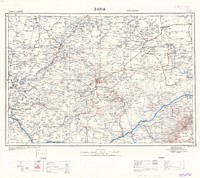
Zaghouan
Map of the region surrounding Zaghouan in northern Tunisia, including Depienne, Pont du Fahs and Djebel Zaghouan, showing state, administrative, district and communal boundaries, with magnetic declination, long distance roads, communication routes, local highways, irregularly maintained dirt roads, logging roads and mule tracks, remains of Roman roads, stone bridges, suspended bridges with supports, footbridges, ferries, fords navigable by vehicle or foot, rivers, forests, marshes, dunes, vines, water sources dry in summer, churches, chapels or holy places, houses, wells and fountains, water and wind mills, fixed and rotating lighthouses, port lights, cannons, cemetries, irrigation canals, trigonometric points, telegraphs, posts. Colour. Relief shown by form lines, contours and shading. Scale 1 : 50.000. -
Zaouiet Madien
Map of mountaineous region surrounding Zaouiet Madien in northern Tunisia with Djebel Bou Goutrane and Foret des Chihia and Debabsa, showing state, administrative, district and town boundaries, with magnetic declination, long distance roads, communication routes, local highways, irregularly maintained dirt roads, logging roads and mule tracks, remains of Roman roads, stone bridges, suspended bridges with supports, footbridges, ferries, fords navigable by vehicle or foot, forests, marshes, dunes, vines, water sources dry in summer, churches, chapels or holy places, houses, wells and fountains, water and wind mills, fixed and rotating lighthouses, port lights, redoubts, batteries, cemetries, irrigation canals, trigonometric points, telegraphs, posts. Colour. Relief in hill shading and form lines and contours. Scale 1 : 50.000. -
Zaria
Map of Zaria Province, Nigeria, and surrounding regions, showing railways, metalled roads, all weather motor roads, seasonal roads, other tracks, paths or explorers routes, telegraph and telephone lines, post offices with telegraph or telephone, wireless telegraph stations, minarets, mosques, fortified houses, lighthouses, ruins, waterpoints: wells and pools, mines and quarries, trigonometrical points, heights in metres, depths in metres, towns, native villages, international, intercolonial, provincial and district boundaries, rivers, canals, lakes, salt lakes, low ground liable to temporary flood, marsh, ground liable to flooding, oasis, sandy desert. Relief shown by contours and formlines. Colour. Scale 1: 1 000 000. -
Zinder
Map of Zinder, Niger, and surrounding areas, showing international, provincial and district boundaries. It also shows lakes, contours, rivers, swamps and sandy areas. Some colour. Scale 1 : 1 000 000
